 Area of Service
Familiar with local conditions of Greater Houston Area or the eight County region (Harris, Fort Bend, Montgomery, Brazoria, Waller, Galveston, Liberty and Chambers Counties.
 Public Utility Design (Sanitary Sewer, Storm Sewer and Water Line)
- Roadway Design
- Civil Site Plan
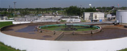
- Lift Station Design
- Storm Water Pollution Prevention Plan (SWPPP)
- Storm Water Quality Management Plan (SWQMP)
- Hydrology and Hydraulic Study / Report
- Traffic Control Plans
- Traffic Signal Design

- Topographic Survey
- ALTA Survey
- Boundary Survey
- Easement Survey
- Elevation Certificate Survey
- Construction Staking
- Platting / Replanting
- GPS Survey
- As-Built Survey
- Control Survey
- Site Survey
 Level 'A' Utility Location: Locate the utility in the field and expose the utility with pothole.
- Level 'B' Utility Location: Locate the utility on the ground using electromagnetic detection techniques.
- Level 'C' Utility Location: Confirm the existence of utility in the field using available record drawings and visually found utility appurtenances.
- Level 'D' Utility Location: Research and coordinate to obtain available record drawings of existing utilities.
ASV Consulting Group, Inc.
Phone: 713-480-9096 |